I love old maps. They’re so artistic and so impractical in helping you navigate.
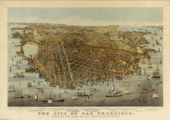
This map of “The City of San Francisco, Birds Eye View from the Bay Looking South-West” drawn in 1878 by Charles R. Parsons is especially detailed and impressive.
For a little context: Victorian houses were starting to pop up around this time, and the city hit 300,000 in 1890 to become the eighth-largest city in the U.S. For a fun close-up look at the details, play around with the map here.
I was surprised by the number of boats. Did Parson include so many because he felt it more accurately represented the bay?
He does seem to have a slight obsession with boats. And for the record, Parsons was an artist and lithographer who was the head of the art department at Harper’s publishing firm.
It's good etiquette to share what you like!